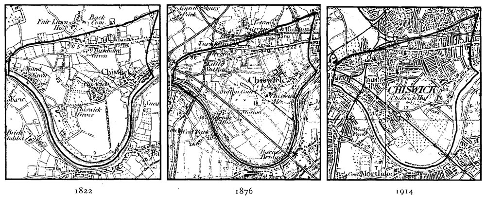
The maps above show how the area changed when Bedford Park was developed
The Key to the understanding of the nature of the names recorded on the parish memorials lies in the history of the development of the Parish of St Michael and All Angels, Bedford Park. The above maps show the development of the Chiswick, Turnham Green and South Acton districts between 1822 and 1914. The map below, dated 1869, soon after the development of the London and South Western Railway, shows a large part of area of the future parish of Bedford Park – largely orchard and arable land north of the railway and Turnham Green station, containing three large Georgian houses, Bedford House in the centre, which gave its name to the future estate, flanked by Melbourne House to its west, and Sydney House (named in the map) to its east.

St Michael and All Angels started out life as a corrugated iron structure, a chapel-of-ease to alleviate congestion at St Nicholas, Chiswick. It was constructed in 1876 on the north side of Chiswick High Road, facing Chiswick Lane, an area of the parish where it was stated, in an application to the Church Commissioners in June 1877 for the creation of a new parish, that there were “3000 souls mostly of the poorer classes, 1000 being very poor. Great numbers were laundresses, labourers in the market gardens and the local breweries.” Because of the recent extension of the District railway greatly increased population was expected – “new houses are likely to be cottages for the poorer classes.”
In the meantime, however, in 1876, the first houses in the future Bedford Park were being constructed in The Avenue, the inspiration of the cloth merchant and aspirant property developer, Jonathan T Carr. From an artistic Dublin family, in 1873, Carr had married Agnes Fulton, the daughter of a civil engineer, Hamilton Fulton, who had purchased and lived in Bedford House with its surrounding land. Carr initially purchased 24 acres of this land from his father-in-law and in time a further 89 acres (some of which was leased from the Church Commissioners, (land that was a detached part of Ealing parish) for his estate, advertised by 1883 as the “Healthiest Place in the World”. His “village”, arguably the first “garden suburb” was planned to be self-contained, with a church, stores, hostelry and club. He had lost no time in persuading the Church Commissioners to allocate land for church and parsonage, and by December 1877 he had secured a grant of £2000 from the Commissioners for the construction of the church; and together with his proposed incumbent, Rev. Alfred Wilson he duly obtained (not without some arm-twisting) an agreement from Rev. Dale of St Nicholas, Chiswick that he would surrender some of the northeast portion of his parish. Thus the population of the new parish became a viable proposition, taking also into account some southern parts of the new parish of All Saints, South Acton. At that early stage, there were only 150 inhabitants of the new Bedford Park Estate. In course of time the estate contained 490 houses occupying 113 acres.
Bedford Park initially attracted particularly “the cultured middle class”, helped by skilful advertising of it in the popular artistic magazines – with its public buildings it formed a compact self-contained village – “Rus in Urbe” – somewhat lampooned in 1882 as “the home of the aesthetes”. Certainly “The Club” was the centre of cultural activity. As the estate grew, towards the end on the century, the social mix gradually changed, with families from trades and professions supplanting some of the more artistic and intellectual original pioneers of the “Colony”. However, it retained its appearance as a self-contained community.
The map below shows the Bedford Park Estate in yellow, the remainder of the parish in orange
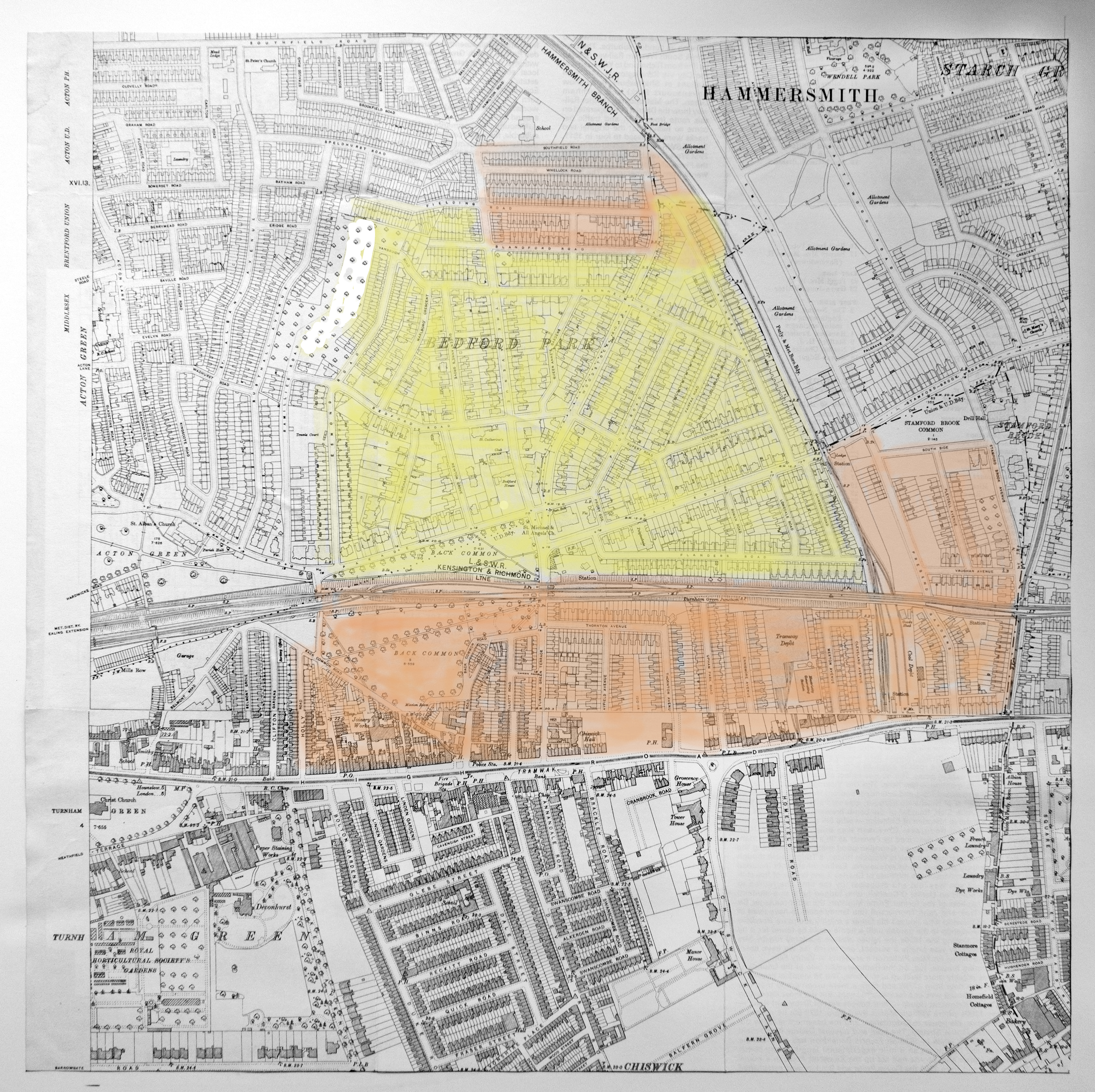
The remainder of the parish, mainly in the area south of the railway and extending to the north side of Chiswick High Road comprised much more densely packed artisanal dwellings, developed to serve the needs of the increasingly industrial parts of Chiswick. The boatyards, the breweries and the market gardens had been augmented by laundries and workshops, as well as a burgeoning commercial and retail sector. Many of the families dwelling here could show three generations having lived in the same place. Some from these would offer domestic service to the Bedford Park residents. In common with many Anglo-Catholic parishes, St Michael and All Angels developed a Mission Church to evangelise and serve the poorer areas of the parish, through a separately appointed Missioner. A Mission Room and Club Room for the Poor was established in a cottage at 9 Nutley Terrace (adjacent to Windmill Road), no longer extant, from about 1894. It was enlarged and refurbished in 1899 and then completely rebuilt in about 1913. Many from the south of the parish would have used the Mission Room as a centre of social activity, especially women and the young. Parish activities such as a womens’ knitting club, boys and girls clubs including the Church Lads’ Brigade and latterly the Scouts would also have attracted some from a wider area.
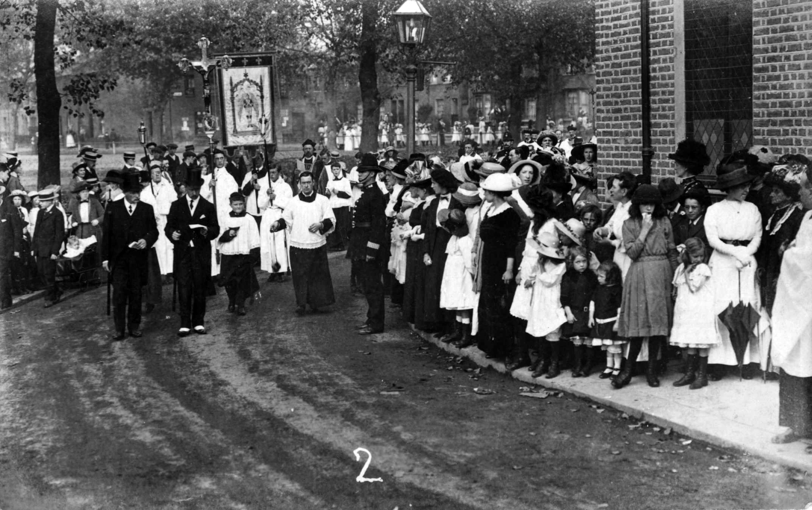
Opening the refurbished Mission Room in 1913
The widely different demographic mix between the north and the south of the parish is fully demonstrated in the chart below of the different people whose names became inscribed in the Bedford Park and Parish memorials and their military ranks. The Parish memorial rather more mimics the proportions of Officers and Other Ranks to be seen nationally, whereas the Bedford Park Memorial Seat, with its 70% Officer proportion in its 40 names clearly emphasises the“Garden Suburb” nature of the middle-class estate.